Pennine Way 2013
Sunday 14th April 2013 – Crowden to Mankinholes
The night had been wet. Thank goodness for the hostel. Had it existed in 1963, we’d have stayed here instead of hauling ourselves to Holmfirth. Now there’s also a busy camp site with a shop, a welcome response to the needs of outdoor enthusiasts at a time when so many rural stores have closed.
At 8am I began a very slow climb to Laddow Rocks. The greater the distance the steadier I start, and this was to be one of my longest sessions. The wind was blustery, and it grew stronger through the day. Frenzied frogs spawned in pools beside the path. Crowden Great Brook ran high. Long strides got me across, but the volume of water convinced me to reject any lingering wish to walk the original route across Dean Head Moss.
Way back then… Early versions of the route to Black Hill ran beside or to the east of Crowden Great Brook. From Black Hill, the instruction in the Ramblers’ Association leaflet was to go “north-west across Wessenden Head Moor, to twentieth milestone on Greenfield-Holmfirth road A635”, but few walk that way now. The Pennine Way wasn’t officially launched until 1965, so the route didn’t appear on Ordnance Survey maps in 1963. Neil had to pencil the line onto maps we borrowed from the library, guided by instructions such as “…on lanes and paths through “g” of New Delight and “w” of Greenwood Lee…” Later Ordnance Survey maps showed the route, though over much of North Derbyshire and South Yorkshire the grim notation “Pennine Way (undefined)” hinted at the challenge. Our 1963 experience included many miles of trackless moors, demanding careful navigation and a much greater physical effort than I was to put in fifty years later.
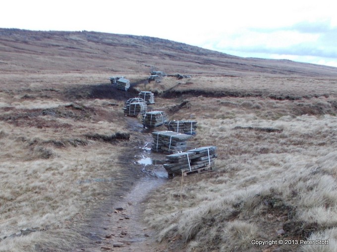
The official Way over Black Hill has been tamed by paving. The man-eating peat need no longer be feared: Black Hill is green, thanks to seeding programmes. Paving isn’t aesthetically pleasing, and it can make your joints ache, but a dose of ibuprofen after dinner takes away the pain of pounding many miles on the slabs.
Tom’s Vision. Tom Stephenson’s call for a Pennine Way was published in the “Daily Herald” in June 1935 under the heading “Wanted – A Long Green Trail”. In 1938 representatives of open-air organisations declared that the Pennine Way should be a continuous footpath linking places of scenic or historic interest, and it should be a way trodden only by walkers, with no artificial surfaces. Almost 30 years later the Way was officially opened. Enthusiastic hikers soon churned the soft peat of Derbyshire and Yorkshire into an ever-widening black morass. Much of the route then had to be paved, and in consequence the walking today is far easier.
Vegetation quickly grew back on the damaged peat. I don’t
bemoan the harsh truth that the natural expression of Tom’s
Vision was doomed to destruction by its inspirational nature and
its huge popularity. Instead I content myself with the sights,
sounds, textures and smells of the high ground, and above all
else, its peace.
From the bleak dome of Black Hill one sees the fields and towns
of South and West Yorkshire, a reminder that the Pennine moors
here reduce to a narrow, inhospitable band between two
conurbations. The fight for access to the fresh air and freedom
of these wild spaces was long and bitter. In my formative years,
water undertakers (a title with grim connotations!) cited
drinking water quality as sufficient reason for demolishing the
Isle of Skye Inn, which then stood beside the A635 road close to
my intended crossing point. The thought of untold numbers of
ramblers crapping in the heather must have rendered them
apoplectic.
During my wind-assisted descent, the leader of a small group of ramblers came plodding upwards, his grim expression suggesting he would be prepared to give his all should battle lines once more be drawn. My cheery “Good morning!” failed to dent his defensive shell. I wondered what pleasure he derived from his outing. I wanted to tell him that a walk on the moors isn’t a military manoeuvre, and that life is too important to be taken seriously. He appeared typical of the leaders I see. Most look burdened with worry. I do wish they’d smile.
At the A635 the mobile café was in business, so I took a mug of tea before marching down the broad track beside the Wessenden Reservoirs. It was good to be out of the wind, passing the time of day with people who expressed astonishment that I was walking from Crowden to Mankinholes in one day, whilst I was equally astounded by their daring exploits on mountain bikes.
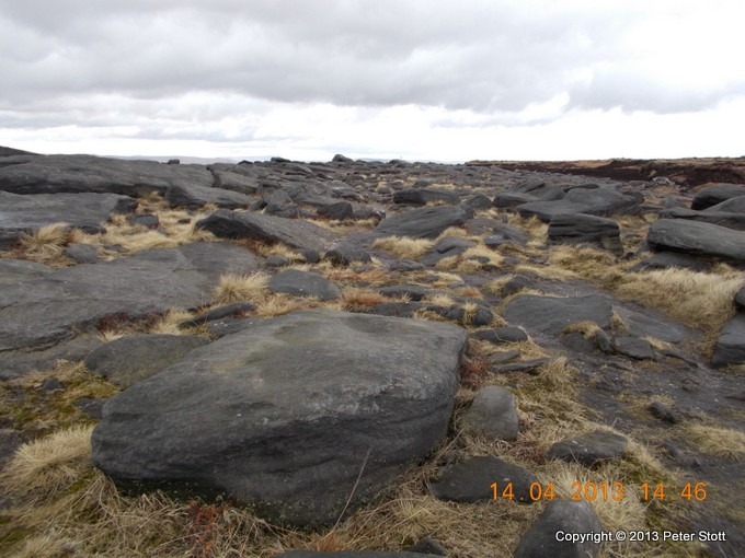
En route to Standedge, the Way crosses the dullest section of moor in the South Pennines (in my opinion). The landscape makes me think of muck-shifting on a major scale: the landforms appear too plain and angular to be natural. Here I met head-on the full force of the wind, which did little to improve my humour. Rain showers hit me in the eye, and for a mile or so I found progress very hard. Light relief came with a sighting of a huge phalanx of hikers walking east in close formation. No wonder they spend so much time discussing clothing and rucksacks: it’s all that most of them ever see. You’ve got to laugh!
I took a rest and a lunch snack at the A62 road over
Standedge, reflecting that progress had been good. All the
significant climbing was behind me, and the wind would now be
blowing on my left shoulder or slightly behind. But the wind
grew fierce, the turbulence staggering. It was hard going along
the top of the crags until the path turned away from the edge,
at which point the worst was over. The walking was
straightforward for the rest of the day, though the wind-chill
forced me to wear hat and hood, coat, gloves and waterproof
trousers.
At 6.30pm I reached Mankinholes YH. The volunteer warden was
checking me in when his wife brought him a large mug of tea.
“I’ll bet Mr Stott would like one of those,” he said to her, and she immediately passed his mug through the hatch to me. What hospitable people! On our 1963 visit the warden’s wife dried our socks in the oven, for which kindness I shall never forget her. I took a quick shower, and then I ate and drank magnificently at the Top Brink Inn and slept soundly.
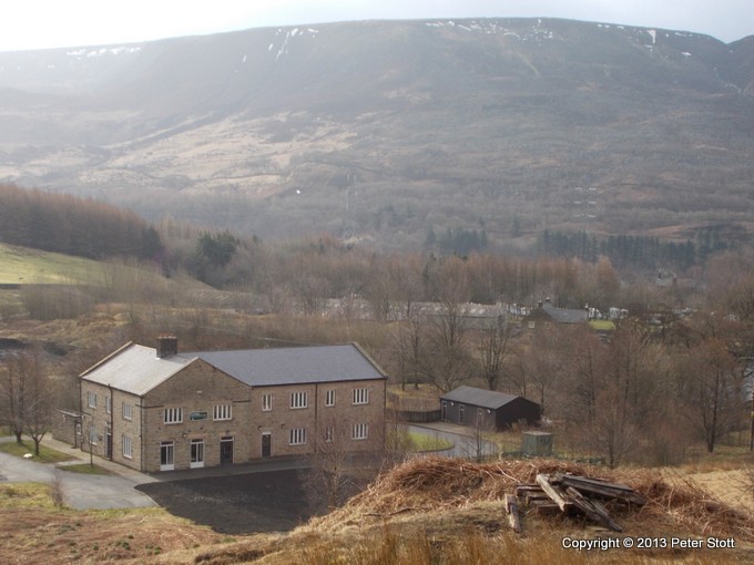
Crowden Youth Hostel and Bleaklow
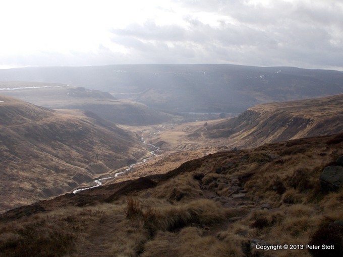
Looking south from Laddow Rocks towards Crowden and Bleaklow
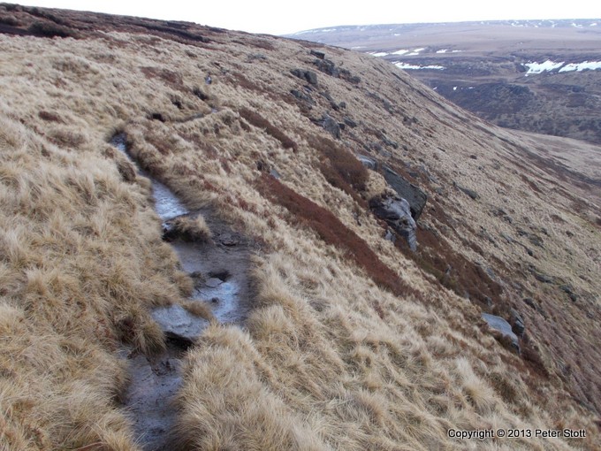
The “Long Green Trail” north of Laddow Rocks
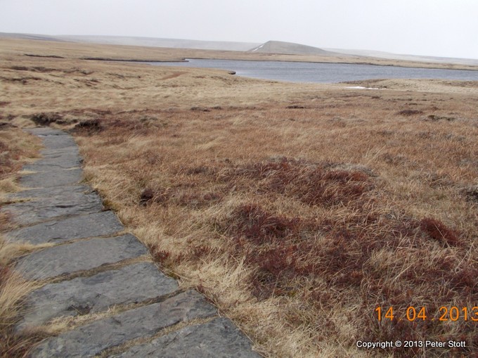
The “Long Paved Trail” near White Moss Reservoir
The Way north of the M62 approaching Blackstone Edge – repairs
pending
On Blackstone Edge – the name says it all
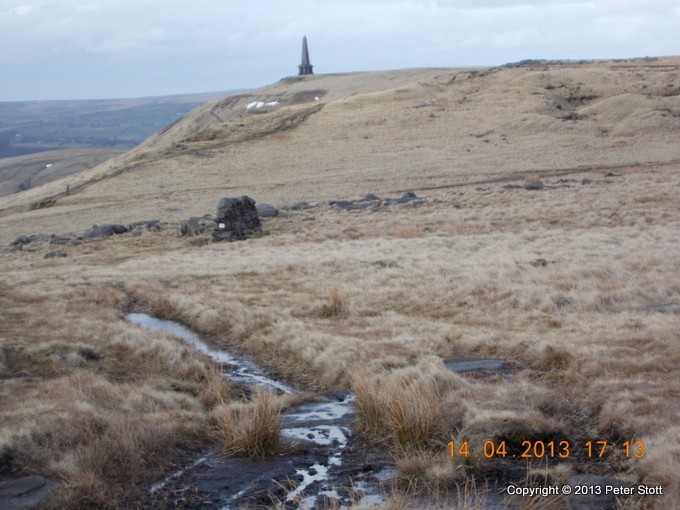
Approaching Stoodley Pike near the end of a long day